EOS-1D X Mark III: GPS Features
| Article ID: ART176368 | | | Date published: 02/03/2020 | | | Date last updated: 09/15/2023 |
Description
Solution
|
GPS Features GPS FeaturesGPS features of the camera can be used to geotag images, set the time, and more. The camera can receive signals from GPS satellites (USA), GLONASS satellites (Russia), and the Quasi-Zenith Satellite System “Michibiki” (Japan). Caution
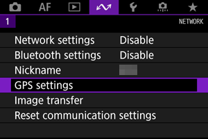
GPS Settings
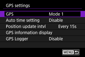
[GPS]Specify the GPS operating mode.
When acquiring GPS signals, use the camera outdoors where the sky is unobstructed and aim it up, keeping your hand and other objects off the top. Signal acquisition under favorable conditions takes approx. 30–60 sec., and then [ Shots taken when [ 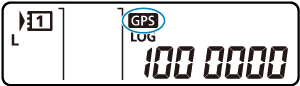 Caution
[Auto time setting]Time information acquired from GPS signals can be set on the camera. The margin of error is approx. ±0.02 sec. Selecting [Auto update] will update the time when GPS signals are received while the camera is on. Caution
[Position update intvl]You can set the positioning interval (time) for updating geotag information. Although tagging is more accurate when the geotag information is updated at shorter intervals, this reduces the number of shots available because it drains the battery faster. Caution
[GPS information display]Shows acquired GPS information. The  You can check geotag information by displaying a shot, pressing the 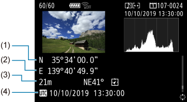
Note
GPS LoggerBy setting [Log GPS position] to [Enable], you can automatically record geotag information at specific intervals along the route that the camera travels. Geotag information is recorded at the interval set in [Position update intvl] as log data saved in the camera's internal memory by date. You can also view the route traveled on a map displayed on a computer. 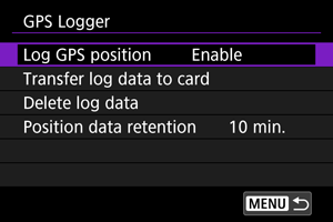 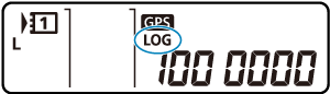 Position update intervals and log data capacity (in days) are as follows.
With one day being equivalent to eight hours of log data
Caution
Transferring log data to a card You can transfer recorded log data to a card selected in [Transfer log data to card]. 
Deleting log data To delete log data in internal memory, select [Delete log data], then select [OK]. It may take approx. 1 min. to delete the data. Position data retention To continue geotagging images even where satellite coverage is poor (if you go indoors, for example) by using geotag information in log data, setting [Position data retention] to [Unlimited] is recommended. The most recently acquired geotag information is added to log data until new information can be acquired. When a time such as [10 min.] is set, after geotag information cannot be acquired, the most recent geotag information is added to log data for the specified period. 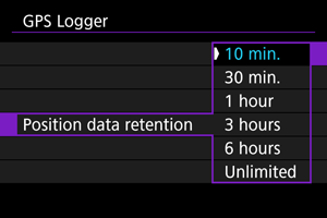 GPS PrecautionsCountries/regions permitting use of GPS functions Use of GPS features is restricted in some countries and regions, and illegal use may be punishable under national or local regulations. To avoid violating GPS regulations, visit the Canon website to check where use is allowed. Note that Canon cannot be held liable for any problems arising from use of GPS functions in other countries and regions. Model number EOS-1D X Mark III: DS126631 (GPS module model: ES300)
|
||||||||||||||||||||||||